
Rieti
The station of Rieti was built in 1883 immediately north of the old town centre, in the area known as Porrara. At the same time, a portion of the city walls was demolished in order to improve access to the station and the current Piazza Mazzini was thus created. A monument to Rieti's fallen soldiers of the Great War would later be erected in this square.
The railway arrives in the Rieti area from Cittaducale through the Valle Oracola, the old border between the Kingdom of Naples and the Papal States. Once past the city, the railway enters the plain and after the Poggio Fidoni stop – at the foot of the Sabine mountains – arrives in the municipality of Contigliano, crossing the Canera stream.
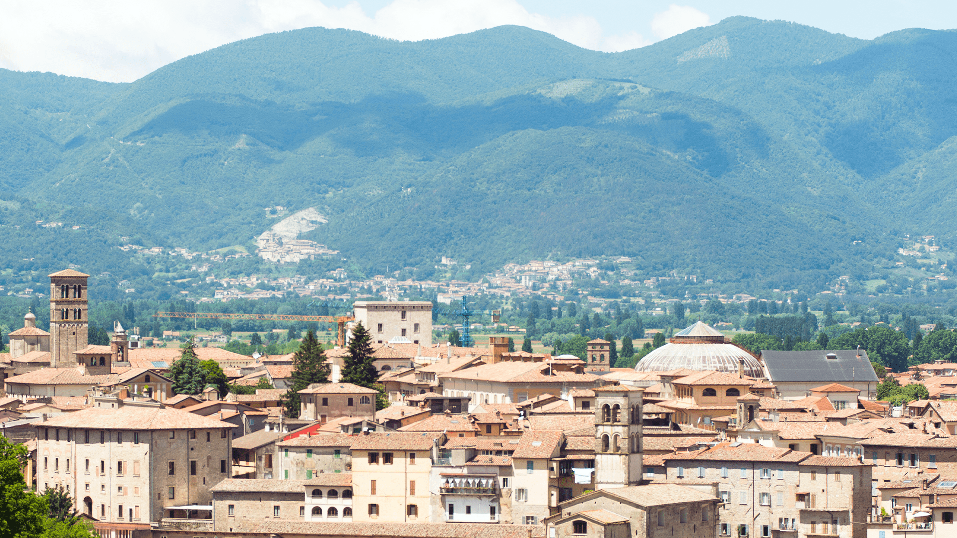
Rieti lies at the south-eastern end of a basin surrounded by mountains, the most famous of which is Mount Terminillo, a ski resort, which at 2217 m is the highest peak in the area and is clearly visible from Rome.
Due to its geographical location, Rieti is traditionally referred to as the “Centre of Italy”.
Inhabited in ancient times by the Sabines, the history of Reate– as it was known in Latin – was always marked by the Via Salaria, which connected it to Rome and the Adriatic Sea, and the river Velino, which formed a vast marshy area in the Rieti basin.
In the 3rd century B.C., the territory of Rieti was drastically transformed. The Roman consul Manius Curius Dentatus, after subjugating all of Sabina to Rome in 290 B.C, carried out the reclamation of the Rieti countryside, which acquired its reputation for extraordinary fertility. Today, however, there are still a few waterbodies in the plain, remnants of the ancient Lacus Velinus. These include the Lungo and Ripasottile lakes, which are protected by a nature reserve for their landscape and biodiversity.
In the early Middle Ages, Rieti was part of the Duchy of Spoleto, later becoming a municipality within the Patrimony of Saint Peter. In the 13th century, several popes chose Rieti as their residence, also because of the strategic importance of the town for its proximity to the Kingdom of Naples. Rieti retains the majestic papal palace and most of the city walls from that time.
In the same years, Saint Francis of Assisi also visited the territory of Rieti. It was at Fonte Colombo – not far from the hamlet of Sant'Elia – that he wrote the Rule for the Order of Friars Minor in the summer of 1223 and it is therefore called the “Franciscan Sinai”. At Santa Maria della Foresta, in the hills north-east of the town, Francis retired in the summer of 1225, according to tradition. These two sanctuaries are connected to Rieti and the other Franciscan places in the “Sacred Valley” by the Saint Francis Walk.
Due to its proximity to the Kingdom of Naples, Rieti was often involved in border disputes. The most famous episode is the first battle of the Italian Risorgimento, fought between the Neapolitan and the Austrian armies on 7 March 1821. The clash took place precisely between Campoloniano and the Valle Oracola, areas now crossed by the railway.
After the unification of Italy, Rieti was aggregated to the Province of Umbria until 1923, when it became part of the Province of Rome. In 1927, the Province of Rieti was finally established, joining the old district of Cittaducale, formerly in the Abruzzi.

Project by Riattivati Youth Cultural Association
With contributions from: FAI – Fondo per l’Ambiente Italiano ETS, INTESA SANPAOLO, Rotary Club Rieti
Thanks To the promotion comittee: Amici di Rieti, Associazione Culturale Giovanile Riattivati, Rotary Club Rieti e Associazione Collezionisti “Sabatino Fabi”